


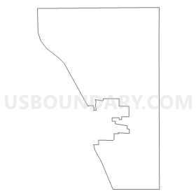
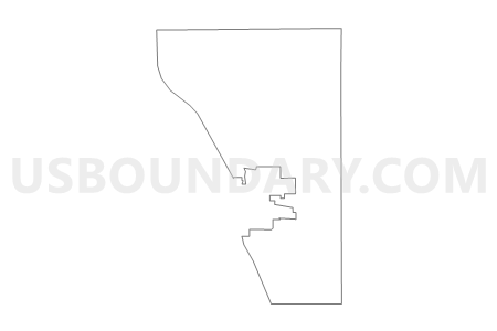
Voting District 0157962000002, Barry County, Michigan
About
Outline
Summary
| Unique Area Identifier | 595893 |
| Name | Voting District 0157962000002 |
| County | Barry County |
| State | Michigan |
| Area (square miles) | 15.05 |
| Land Area (square miles) | 14.85 |
| Water Area (square miles) | 0.20 |
| % of Land Area | 98.66 |
| % of Water Area | 1.34 |
| Latitude of the Internal Point | 42.73378790 |
| Longtitude of the Internal Point | -85.44673950 |
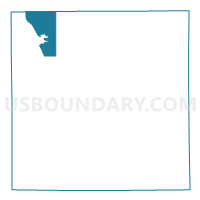
Maps

Graphs
Select a template below for downloading or customizing gragh for Voting District 0157962000002, Barry County, Michigan


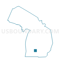
Neighbors
Neighoring Voting District (by Name) Neighboring Voting District on the Map
- Voting District 0154112000001B, Barry County, MI
- Voting District 0154112000002, Barry County, MI
- Voting District 0157042000001, Barry County, MI
- Voting District 0157962000001, Barry County, MI
- Voting District 0157962000003, Barry County, MI
- Voting District 0158902000001, Barry County, MI
- Voting District 0810978000001, Kent County, MI
- Voting District 0811250000001, Kent County, MI
- Voting District 0811250000004, Kent County, MI
Top 10 Neighboring County Subdivision (by Population) Neighboring County Subdivision on the Map
- Caledonia township, Kent County, MI (12,332)
- Thornapple township, Barry County, MI (7,884)
- Yankee Springs township, Barry County, MI (4,065)
- Rutland charter township, Barry County, MI (3,987)
- Irving township, Barry County, MI (3,250)
- Bowne township, Kent County, MI (3,084)
Top 10 Neighboring Place (by Population) Neighboring Place on the Map
Top 10 Neighboring Unified School District (by Population) Neighboring Unified School District on the Map
Top 10 Neighboring State Legislative District Lower Chamber (by Population) Neighboring State Legislative District Lower Chamber on the Map
- State House District 72, MI (103,319)
- State House District 86, MI (99,294)
- State House District 87, MI (96,428)
Top 10 Neighboring State Legislative District Upper Chamber (by Population) Neighboring State Legislative District Upper Chamber on the Map
Top 10 Neighboring 111th Congressional District (by Population) Neighboring 111th Congressional District on the Map
Top 10 Neighboring Census Tract (by Population) Neighboring Census Tract on the Map
- Census Tract 103, Barry County, MI (7,884)
- Census Tract 148.07, Kent County, MI (6,964)
- Census Tract 114, Barry County, MI (6,408)
- Census Tract 120.02, Kent County, MI (6,100)
- Census Tract 102, Barry County, MI (5,641)
- Census Tract 148.06, Kent County, MI (5,368)
- Census Tract 104.02, Barry County, MI (4,065)